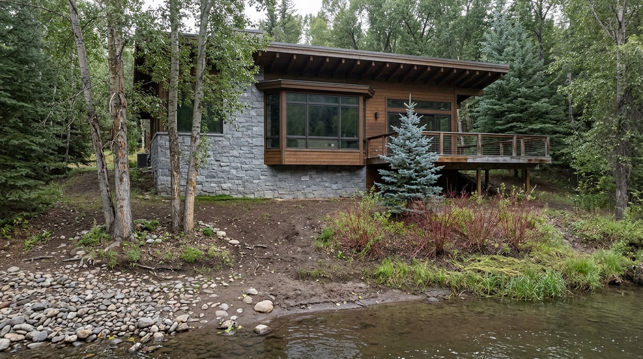
East Aspen Hiking Trails for Year-Round and Seasonal Use
August 27, 2026
August 27, 2026
Most mornings, whoever lives closest to the Hunter Creek trailhead just walks out the door. No trailhead parking lot to circle, no thirty-minute drive up a two-lane highway, no gate to check. That's the version of East Aspen recreation nobody puts on a postcard: not the alpine lake, not the ghost town, just a dog and a creek and however much daylight is left before work.
The rest of the neighborhood's outdoor life runs on a completely different schedule, and most people who live here have never had to think about why. It comes down to a line item buried in a Colorado Department of Transportation maintenance report: Independence Pass is a highway with a closing time.
Hunter Creek is the exception that makes the rest of the corridor make sense. The trail starts a short distance from downtown and climbs steadily, gaining more than 700 feet in its first mile before the grade eases into something closer to a stroll, according to the City of Aspen's own trail page. Go the full distance and you're looking at 8.9 miles round trip with roughly 1,128 feet of total elevation gain, a four to four-and-a-half hour outing if you want it. Most locals don't want it. They want the first mile and a half, the part that runs alongside the water before the old homestead loop, and they want it on a Tuesday morning before the tour groups arrive.
Because tour groups do arrive. The Aspen Chamber runs a seasonal "Leisure Hike" through the same ground, describing it as a route that connects trails, hidden neighborhoods and nature paths east of town along the Roaring Fork River and Hunter Creek, with most of the walking happening beside flowing water. ACES, the local naturalist nonprofit, calls the trailhead "Aspen's back door" and sends guides out to narrate the valley's ecology and history on request. Both descriptions are accurate. Both also mean this particular trail is doing double duty, functioning as a genuine daily-use amenity for the people who live nearby and as a curated experience for everyone else.
The trade-off locals have worked out is timing, not avoidance. Early or on a weekday, the leashed stretch near the trailhead gives way to open trail deeper into the valley, and the crowd thins fast. This is the one piece of East Aspen's outdoor inventory that asks nothing of the calendar. No gate closes it. No maintenance crew shuts it down for the season. It's simply there, twelve months a year, which is more than can be said for almost everything else east of it.
Highway 82 east of town turns into Independence Pass, and the pass has an opening date and a closing date, set by CDOT based on snowpack rather than the calendar. This year it opened at noon on May 21, after crews spent the spring replacing damaged guardrails, filling potholes, resurfacing heaved sections of roadway, trimming overgrown brush, removing downed trees and clearing rockfall from the drainages. That's a fairly typical timeline. CDOT's own project records note the pass usually reopens the Thursday before Memorial Day and typically closes again on or near November 7, though the range has been wider in practice: as early as May 11 in 2012, as late as June 5 in 2008, according to reporting from Colorado Public Radio. Last season it closed on November 17, after an early storm forced a temporary shutdown that CDOT then extended for the winter.
What that means in practice is that everything past the Hunter Creek turnoff, every trailhead, every swimming hole, every campground along the corridor, operates on borrowed time each year. Locals plan around it without necessarily naming it that way. There's also a practical detail worth knowing if you're hauling anything: vehicles and trailers with a combined length over 35 feet are prohibited on the pass between mile point 47.2 near Aspen and mile point 84.2 near Twin Lakes, a restriction tied to the tight curves and narrow lanes on the higher sections.
| Stop | Distance from downtown | What it's for |
|---|---|---|
| Difficult Creek Trail | About 5 miles, from Difficult Campground | A quieter climb, fewer people than Hunter Creek |
| Weller Lake Trail | About 8 miles up the pass | A moderate out-and-back to a lake ringed by boulders and pine |
| Devil's Punchbowl | About 9 miles, near mile marker 50 | A roadside swimming hole carved by the Roaring Fork River |
| Grottos Day Use Area | About 9 miles | Ice caves, a waterfall, and a three-quarter-mile loop easy enough for kids |
| Independence ghost town | About 16 miles | Remnants of the valley's first mining site, discovered in 1879 |
| Lost Man / Independence Lakes | 14 to 18 miles, depending on trailhead | A long day hike through alpine meadow to two backcountry lakes |
The spread matters more than the individual entries. Nothing on that list is more than a twenty-minute drive from a house in East Aspen, but every one of them requires the drive, and every one of them disappears for roughly half the year when the gate swings shut. That's the actual geography locals are managing: a walkable, year-round amenity right at the edge of the neighborhood, and a seasonal, car-dependent system stacked behind it.
Devil's Punchbowl deserves a specific note, because it's the stop most likely to end up on a family's list without anyone reading the fine print first. It's a natural pool fed by a waterfall, with no lifeguard, no railing, and a current that changes fast with runoff. The Aspen Times quoted the Pitkin County Sheriff's Office as saying: "We hate to say there's a history of it, but there's a history of it." The pull-off has no official parking lot and no signage, which is part of its appeal and part of the reason people underestimate it. Grottos, a few minutes further up the road, is the version of that same stretch of river built for a family picnic rather than a cliff jump.
Here's the part that doesn't show up on any trail app. The seven toilets scattered along the corridor at the Grottos, upper Lost Man, and the summit don't clean themselves, and the federal budget that used to cover that work has shrunk. The Independence Pass Foundation, a local nonprofit, has stepped in to fund professional cleaning five days a week for as long as the pass is open each year, with its own staff and volunteers covering the remaining two days. The foundation has also taken on full responsibility for trash pickup at every restroom, day-use area, trailhead and pullout along the route, a job that used to be split between the Leadville and Aspen-Sopris Ranger Districts. On the trail maintenance side, the foundation partners with Roaring Fork Outdoor Volunteers and the U.S. Forest Service to keep the Lost Man and Linkins Lake trails passable, work that happens quietly every summer without much fanfare.
None of this changes where anyone hikes. It does explain why the corridor still feels maintained despite running on a fraction of the institutional support it used to have, and it's worth knowing the next time you find a clean restroom nine miles up a mountain highway.
As of late August, the pass is open and will stay that way for roughly another ten weeks in a typical year, give or take how early winter decides to arrive. If there's a Lost Man Lake hike or a night at Lincoln Gulch still on the list, this is the stretch of calendar to use it, alongside the corridor's other campgrounds at Difficult, Weller and Lost Man. Hunter Creek isn't going anywhere. The rest of it is working on a different clock, and the difference is worth remembering before the gate closes for the winter.
If you're weighing what East Aspen actually offers day to day, not just on a listing sheet, that's the kind of detail the Shea Team builds into every conversation with buyers and sellers in this corridor. Connect with the Shea Team when you're ready to talk specifics about the neighborhood, the market, or the mountain behind it.
This article is general information, not legal, tax or financial advice. Consult a qualified professional about your situation.
Stay up to date on the latest real estate trends.

We are committed to guiding you every step of the way—whether you're buying a home, selling a property, or securing a mortgage. Whatever your needs, we've got you covered.

415 EAST HYMAN AVE ASPEN, CO 81611